EARLY ISLAMIC GRAVESTONES FROM SUMATRA
MAHS PI R. Michael Feener, Co-PI Patrick Daly and their colleagues from the Aceh Geohazards Project have just published a new article on early Muslim gravestones in Sumatra:
Michael Feener, Patrick Daly, E. Edwards McKinnon, Luca Lum En-Ci, Ardiansyah, Nizamuddin, Nazli Ismail, Tai Yew Seng, Jessica Rahardjo & Kerry Sieh, ‘Islamisation and the formation of vernacular Muslim material culture in 15th-century northern Sumatra,’ Indonesia and the Malay World49 (2021):143, 1-41, DOI: 10.1080/13639811.2021.1873564
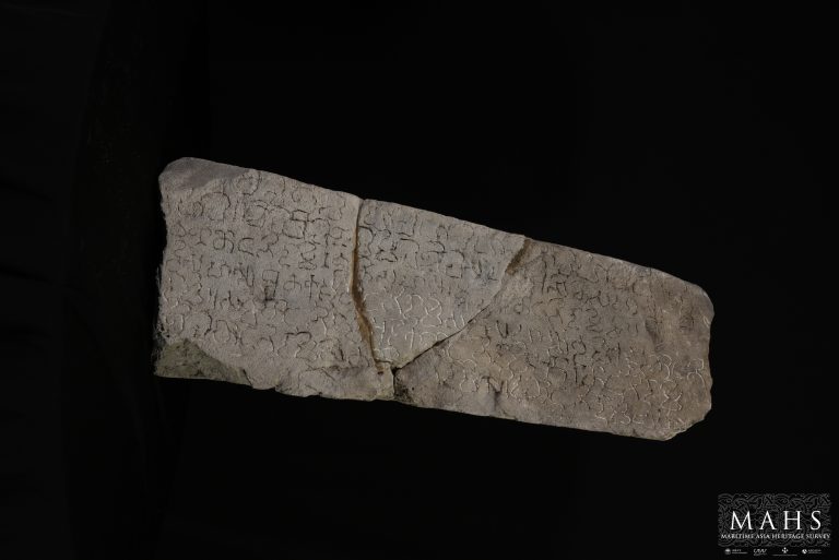
![]() Plang-pleng: A form of early Muslim gravestone from Southeast Asia
Plang-pleng: A form of early Muslim gravestone from Southeast Asia
This study presents a distinctive type of Muslim gravestone found on the northern coast of Sumatra, Indonesia, that dates to the 15th century. These grave markers, locally known as plang-pleng, provide evidence for the formation and disappearance of an early form of vernacular Muslim material culture in Southeast Asia. Our work demonstrates that plang-pleng gravestones were initially a cultural product of the historic trading settlement of Lamri dating from the early 15th century, whence variations on the form spread to other sites along the northern coast of Sumatra.
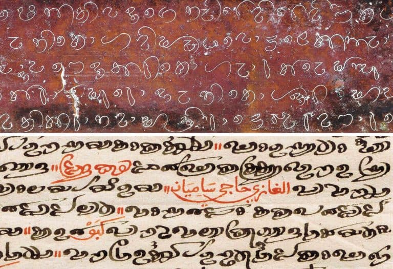
Our survey has developed a typology of stylistic variations of plang-pleng stones based upon shape, morphology and ornamentation. This also revealed clear correlations of specific types with their relative chronologies based on dated Arabic inscriptions and patterns of spatial distribution.
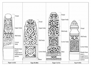
Typology of plang-pleng stones developed in the article (sketch by Luca Lum)
The relatively tight constraints on both the geographic range and the chronology of dated plang-pleng stones presents a striking case of the emergence of a distinctive localised form of Muslim visual and material culture during a pivotal phase in the history of Islamisation in Southeast Asia. The short-lived but distinctive plang-pleng tradition reflects the aesthetic choices of a heretofore under-studied coastal community as it came to identify itself as Muslim over a pivotal period of history, during which the Indonesian archipelago was becoming increasingly integrated into the expanding religious and economic networks of a maritime world of Islam.
The data presented and analyzed in this article was collected by the Aceh Geohazards Project, (AGP), an extensive archaeological landscape survey conducted by a team of Acehnese researchers between 2015 and 2018 across approximately 40 km of coastal villages on either side of the city of Banda Aceh in northern Sumatra. The main aims of this project were to combine archaeological and geological data to determine if areas inundated by the 2004 Indian Ocean tsunami had been hit by previous historic tsunami, and to better understand the history of that coastal region before the rise of the Aceh sultanate in the 16th century.
The AGP documented over 200 plang-pleng among a broader sample of over 5,000 gravestones. The field team worked village by village to locate and document all historic material culture visible on the ground surface of the survey area (Figure 1). This included structures, scatters of material culture such as ceramic sherds, and carved stone grave markers. They made detailed records for each grave marker that includes a physical description, GPS coordinates, and detailed photographs of each stone showing all sides, as well as close up shots of the main decorative motifs and calligraphic panels.
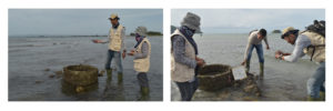
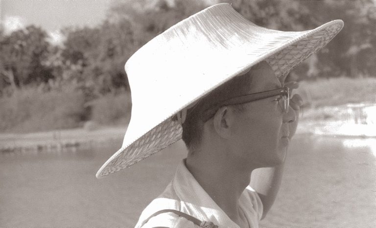
The Aceh Geohazards Project field team at work
The AGP was a collaborative effort by the Earth Observatory of Singapore and the International Centre for Aceh and Indian Ocean Studies (ICAIOS) to study the impacts of natural hazards upon past communities along the Aceh coast. The Field Survey Team was led by Maida Irawani (Project Manager), and included Hayatullah (field team leader); Dedi Satria, Sri Wahyuni, Multia Zahara, Cut Salfiana, Fitriani, Jovial Pally Taran, Assauti Wahid, Ahmad Zaki, Aris Munandar, Ariyusnanda, Amir Husni, Andri A.Gapi, Ayu Mujiburrahmi, and Muhammad Ikhsanuddin (heritage survey team); Jihan, Pratitou Arafat, Muksalmina, Arie Yamani, Sari Novita, Masykur Syafruddin, and Rita Zahara (artifact and data processing); and Safrida, Cut Dian Fitri, Huliatun Adnin, and Evan (administrative and logis- tical support). Their work was supported by the National Research Foundation of Singapore, and the Singapore Ministry of Education under the Research Centres of Excellence initiative, comprising Earth Observatory of Singapore contribution no. 338.
The full article and supplementary materials is available open-access for download at:
https://www.tandfonline.com/doi/full/10.1080/13639811.2021.1873564