Skip to content

Maritime Asia Heritage Survey

  • Home
  • About Us
    • Team
    • Opportunities
    • Contact Us
    • Citation
  • Countries
    • Maldives
    • Indonesia
    • Thailand
  • Resources
    • All Resources
    • Timeline
    • Illustrated Glossary
    • Maldives Virtual Library
    • MAHS Blog
  • Data
    • Database
    • Manuscript Viewer
    • 3D Model
    • Point Cloud
    • Oral Histories
    • Special Collections
    • Fieldwork Gallery

Manuscript Type: Maps

BACK
Filter manuscripts
Search Manuscript
Filter by Country
Manuscript Location filter

MAHS-MDV-COL-001-O-0037

Maldives
historical maps Maps

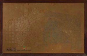
This color-coded map does not carry any information on its cartography, and is not dated, but it’s relative chronology can...

MAHS-MDV-COL-001-O-0036

Maldives
historical maps Maps

This map of Malé was produced in 1986 by pasting together multiple tiles of A3-sized paper. It is much faded,...

MAHS-MDV-COL-001-O-0032

Maldives
historical maps Maps

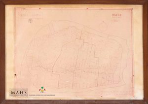
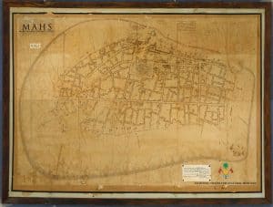
This map was prepared by the Maldives Land Registration Division in 1978. The title is printed in English at top...

MAHS-MDV-COL-001-O-0031

Maldives
historical maps Maps

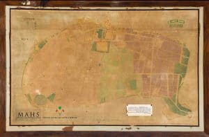
This colored map of the capital island was produced in 1950. It was commissioned by Mohamed Amin Didi shortly before...

MAHS-MDV-COL-001-O-0030

Maldives
historical maps Maps

This map was done in the 21st year of the second reign of Sultan Muḥammad Shams al-Din III. Work on...

MAHS-MDV-COL-001-O-0029

Maldives
historical maps Maps

This map was drawn during the 19th year of the second reign of Sultan Shams al-Din III (1921). The survey...

Maritime Asia Heritage Survey
Center for Southeast Asian Studies,  Kyoto University
46 Shimo-Adachi, Yoshida, Sakyo-ku, 
Kyoto  606-8501
JAPAN

〒606-8501
京都市左京区吉田下阿達町46
京都大学東南アジア地域研究研究所

(+81) 075-753-7314 MAHS@cseas.kyoto-u.ac.jp
  • Project leader
  • Citation
  • Privacy
  • Terms of use
  • Project leader
  • Citation
  • Privacy
  • Terms of use
Facebook-f Instagram Linkedin-in X-twitter
© Maritime Asia Heritage Survey 2025. All rights reserved.
MAHS data may not be used for, in the development of, or as inputs to generative AI programs